LASER SCANNING
ABOUT LASER SCANNING
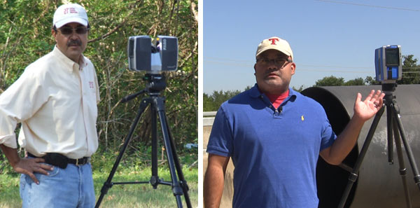
Terrestrial laser scanning is a ground based system of measuring position and dimensions of objects using emitted laser light. The unit collects millions of measured points in space with each scan as well as photographing the scene. The scans produce a point cloud. The scanner also captures GPS coordinates and quality control information of each scan.
- Each scan typically takes less than 10 minutes. Overall field time depends on scope of scene.
- Phase shift laser scanners typically provide accuracy of approximately 1/8 of an inch.
- TLS measures hundreds of millions of points of each scene. It is a digital copy of the scene.
- The decrease in price of the scanners is leading to TLS being the standard for forensic scene and object documentation. The data forms the basis for significant use in close range photogrammetry.
- TLS provides more complete and accurate data of the scene and physical evidence, thereby providing a very solid foundation for any reconstruction or analysis.
- The low cost for scanning provides an argument for scene preservation in most significant injury cases. No more lost physical evidence. Scanning starts at $1,500 plus travel.

- The deliverables from the scan are more than sufficient for mediation or settlement purposes with only minimal additional costs. The deliverables from scanning include the point cloud, i.e. scene data, and an animated point cloud fly through.
Legal Forensic
Animations
Contact Us
About 21st!
Established in 1989, 21st creates sophisticated 3D computer visuals for litigation. We are retained by counsel to create the 3D graphical presentation of expert opinion. We provide the technical support to create accurate and informing exhibits to better communicate the events in question.
Contact Us!
andres@call21st.com
+1 (800) 460-2887
209 W 2nd St #255, Fort Worth, TX 76102
Have Questions?
30+ Years Of Exp


Copyright 2021 21st Century Forensic Animations. All Rights Reserved